


Surville Carteret

Roulland
User

Length
11.9 km

Max alt
17 m

Uphill gradient
66 m
Km-Effort
12.8 km

Min alt
0 m

Downhill gradient
62 m
Boucle
No
Creation date :
2021-07-24 06:55:43.082
Updated on :
2021-07-24 16:58:17.531
4h00
Difficulty : Easy

FREE GPS app for hiking
 SityTrail
IGN / Geographical institutes
SityTrail Plus
The world is yours!
About
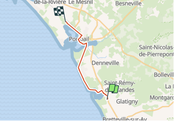
Trail Walking of 11.9 km to be discovered at Normandy, Manche, La Haye. This trail is proposed by Roulland.
Description
Tracé non correct
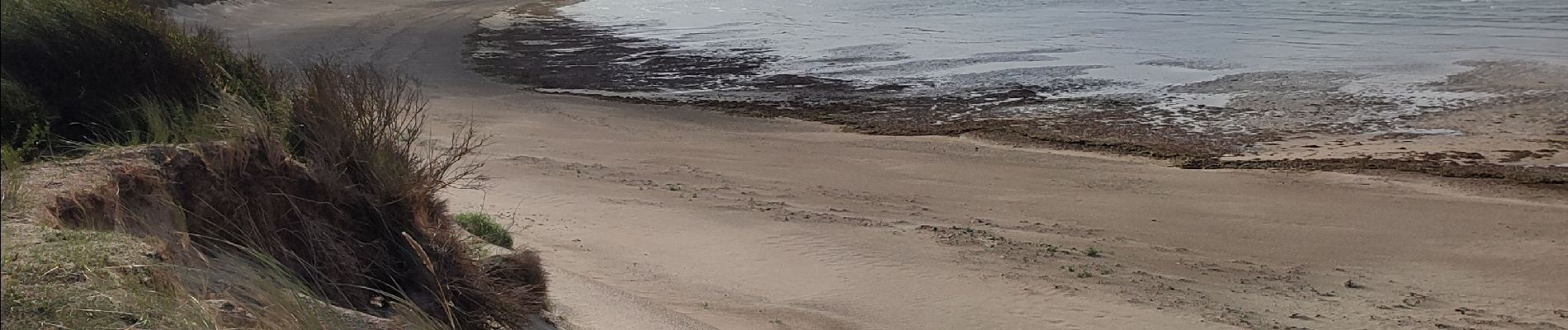
Photos


Positioning
Country:
France
Region :
Normandy
Department/Province :
Manche
Municipality :
La Haye
Location:
Surville
Start:(Dec)
Start:(UTM)
597610 ; 5459333 (30U) N.
Comments